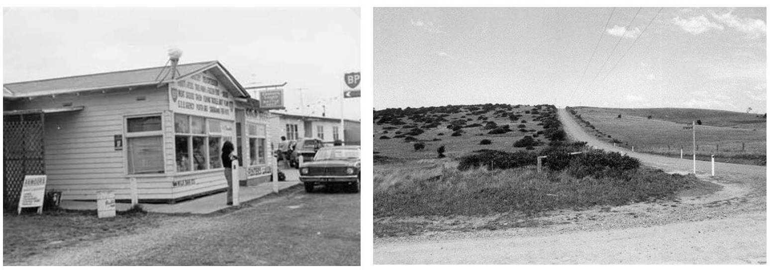
More than 12,000 years ago, when the sea level was six metres higher than today, Wilsons Prom was a group of islands with only the mountain tips showing above water level. When the sea level dropped to its present level, the Yanakie Isthmus and Peninsula formed what is now Wilsons Promontory National Park.
'YANAKIE' (pronounced yan-a-key) is a Koori name from the Gunai (Kurnai) language interpreted generally as 'between waters'. Wilsons Promontory was first traveled by the Koories. These people were of the Gunai (Kurnai) community with the Brataualung clan occupying the surrounding areas of the Prom Coast and South Gippsland. To the Koories, Wilsons Promontory is known as 'Wamoon', (also known as Yirik or Woomom). These people had been spending part of their year on the Yanakie Isthmus and used the area as a valuable food source, particularly in summer. Evidence of an early history of Aboriginal occupation of Wilsons Promontory National Park is shown through archaeological records dating back at least 6500 years.
George Bass first sighted the promontory on 2nd January 1798 from a small whaleboat while on an excursion from Port Jackson. George Bass and Matthew Flinders were probably the first Europeans to see The Prom. Bass named the area in honour of his friend, a London merchant named Thomas Wilson. Bass returned with reports of plentiful supplies and safe anchorage, as well as 9000 seal pelts and several tons of oil. This initiated a sealing rush which petered out in the 1830s as the number of seals dwindled. Whaling was also practiced from Refuge Cove until they also became too scarce for commercial viability in the 1840s.
The Yanakie district was first settled in 1850 and the area, including what is now Wilsons Promontory National Park, was used to graze cattle and sheep.
A lease was granted in 1852 for northern section of Yanakie for the Yanakie Station or Run (a profitable business), which grazed cattle through to Darby River.
In 1859 it was realised that The Prom's position meant it was important for navigation for the turbulent waters of Bass Strait, and a lighthouse was built on South East Point.
Tin was discovered near Corner Inlet in the 1870s. However, it was not mined until World War I stimulated demand and it ceased in 1925 with the opening of the Mount Hunter mine.
After visits by naturalists and botanists in 1884, campaigning for government protection of the site began competing with cattle interests and settlement plans. Following campaigns by the Field Naturalists Club of Victoria, and lobbying by the Royal Society of Victoria, the Victorian Government temporarily reserved most of the Promontory as a national park in 1898.
In 1905 the National Park was declared, and the remaining area has developed into a prosperous and friendly farming community and, more recently, a popular destination for tourists.
The main entrance road was not completed until the 1930s. During World War II the Prom was used for commando training and was closed to the public. Yanakie has only been developed into dairying country since the 1950's.
In 1954, the Government Settlement Scheme cleared and subdivided the Peninsula. The Yanakie Isthmus, a sandy bar connecting the promontory to the mainland, was added to the park in the 1960s. The entrance road was sealed in 1970-71 with visitor numbers increasing steadily.
Download Heritage of Wilsons Prom Brochure
